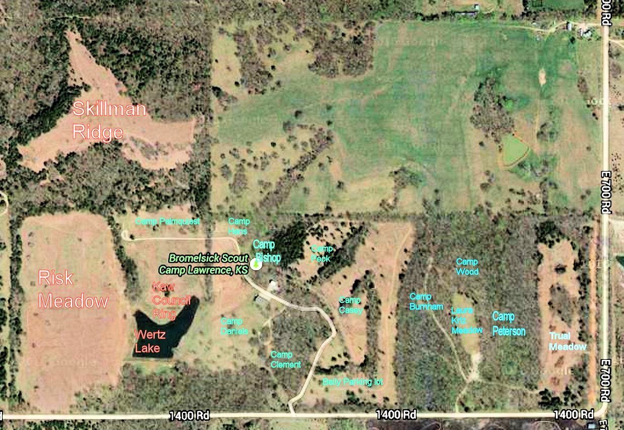
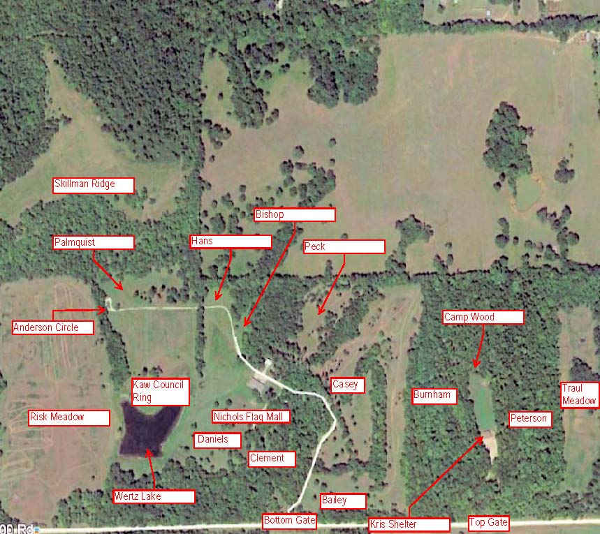
Campsite map
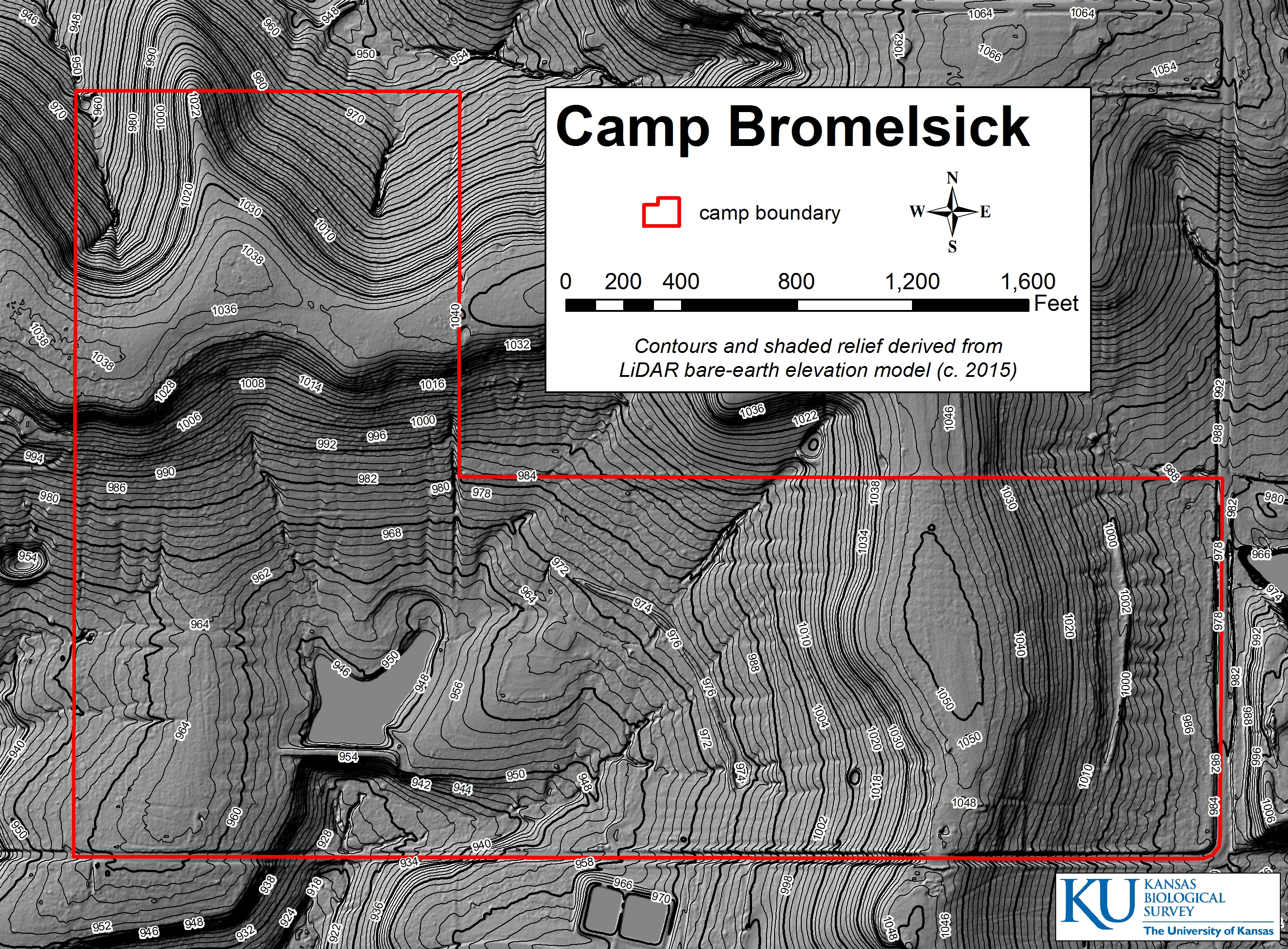
Contour Map
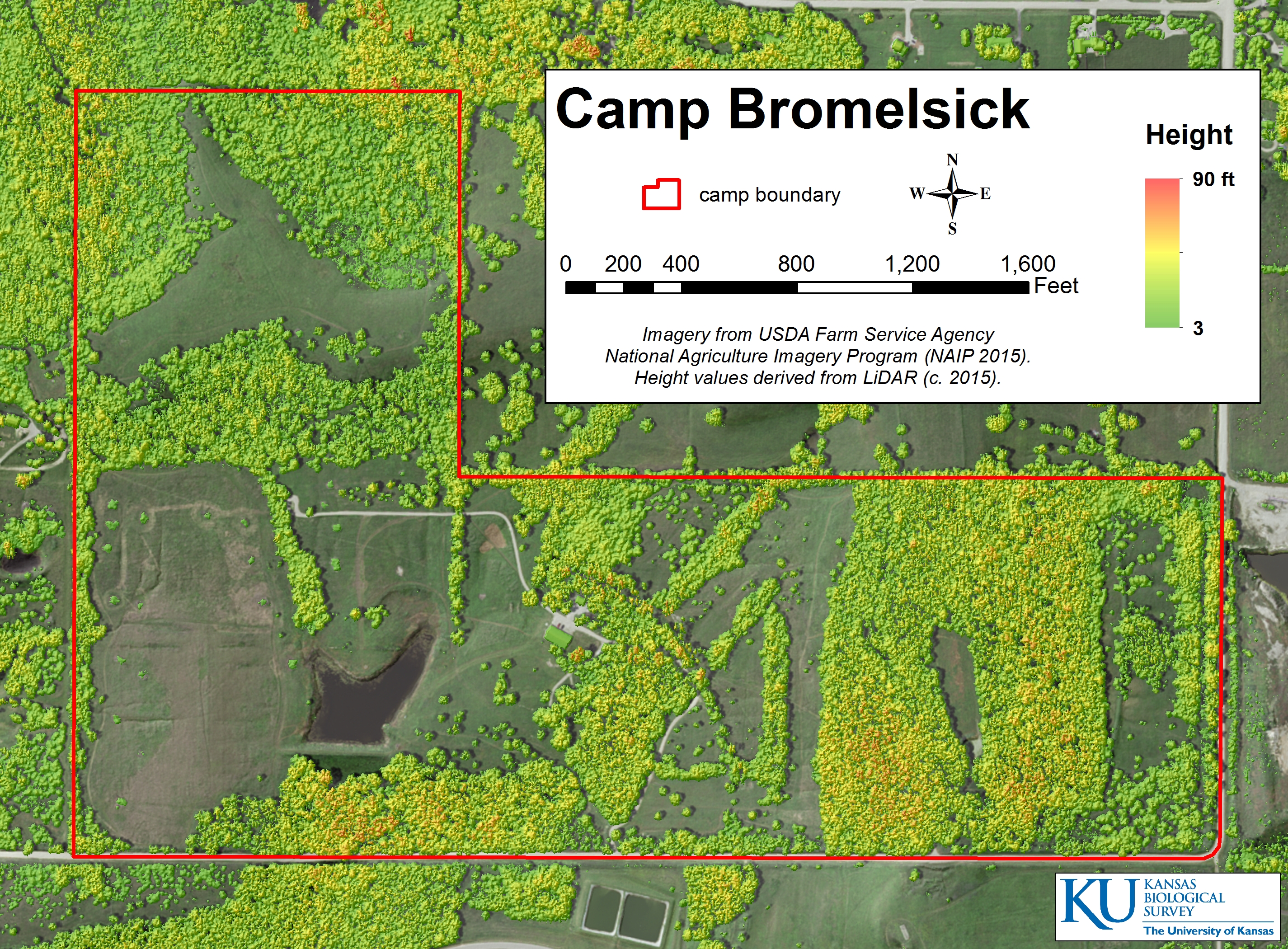
Vegetation Map of Bromelsick
Directions to Bromelsick
Clinton Lake Trails Map
Anderson Trail
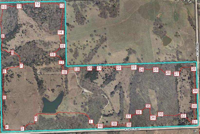
Navigation Course
Bromelsick Scout Farm
Home
Many units are interested in doing a hike when coming to the property. The Anderson Trail on the property is a little over 2 miles long and provides a nice short hike. If you want to do a longer hike you can do the Anderson trail then pick up the Clinton Lake trails by going out the bottom gate and turning left onto N1400 Rd (heading east). Located about 100 yards on the south side of N1400 road is a driveway. You can cross over into the Clinton State Park through this driveway. (You can not drive through because the gate is kept locked by the State) From there you can pick up the trails. See the Clinton Lake Trails Map. The Clinton Trails map is orientated with South at the top of the map. You will enter the property just to the West of Bunker Hill. The trails provide a number of opportunities to return back to Bromelsick using the black top roads in the State Park or coming back from the far West end of N1400 Road.
Click below on the desired map to download it.
Campsite map
Contour Map
Vegetation Map of Bromelsick
Directions to Bromelsick
Clinton Lake Trails Map
Anderson Trail
Navigation Course
Bromelsick Scout Farm
Home